Map Of Bath's History
We are very pleased to announce our collaboration with the Historic Towns Trust, who are a registered charity, to produce a new historical map of our city. The Trust have already successfully produced and published more than a dozen historical maps of cities around the UK. These include Medieval London, Bristol in 1480, Oxford from Medieval to Victorian Times, and, the most recent, Cambridge. These maps sell through book and map retailers and have proved very popular. To produce an historical map of Bath we need to raise £15,000 which largely pays for the cartography and printing of the map. The History of Bath Research Group are contributing some of this initial capital and profits from sales will be split between the HBRG and the Trust. However, in order to help us achieve this target we are asking for contributions from our members and supporters.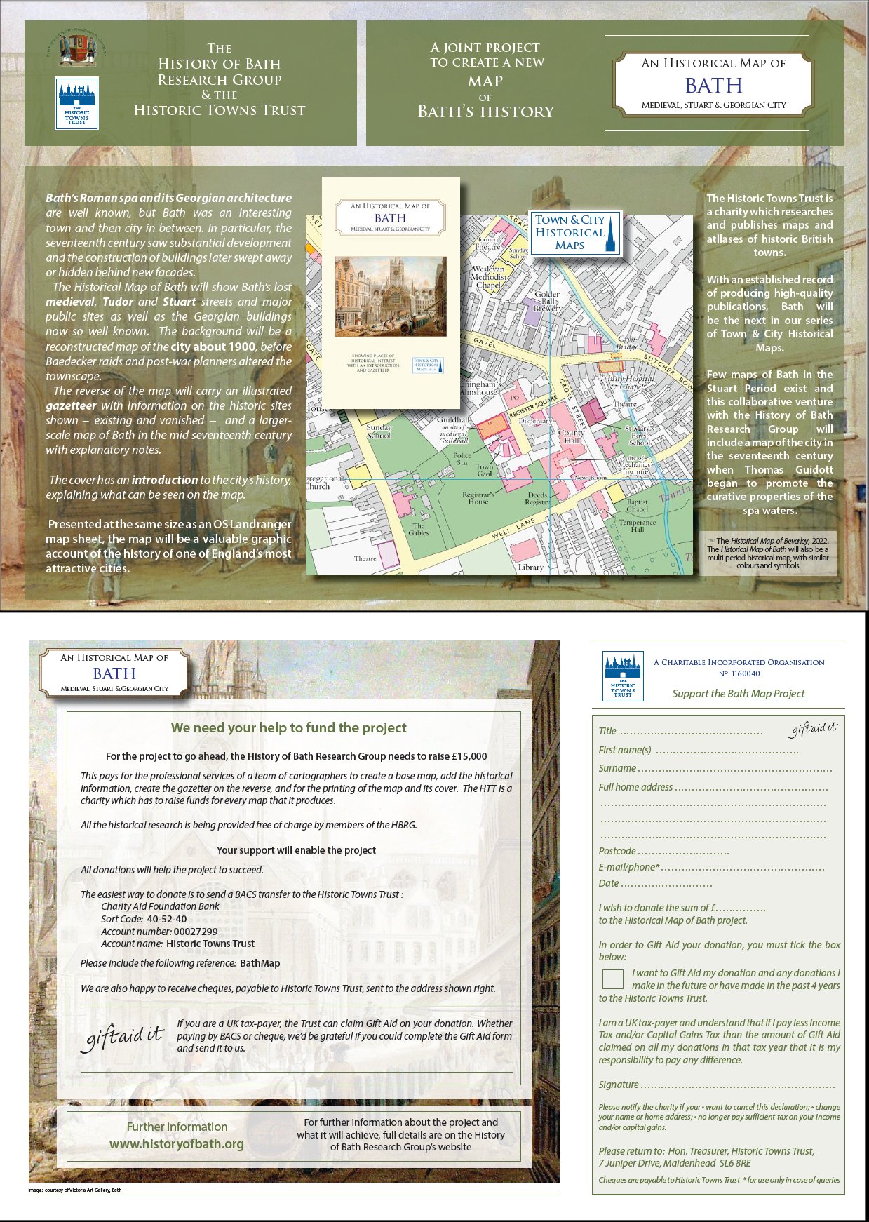
The New Historical Map of Bath
The history of Bath is well covered for Roman times, the Georgian period and later but there is a gap for the intervening period. Our map will cover these periods but also looks at Bath in the seventeenth century. It will be a double sided map similar in format to Ordnance Survey Land Ranger maps but at 1:2500 scale with a background plan of about 1900 and the main sites and buildings of interest throughout Bath's history highlighted in colour on the front. The reverse will show more detail of the seventeenth century and will also be illustrated with contemporary pictures of the city, mainly from The Victoria Art Gallery collection, and descriptions of the main buildings and areas of interest.An Appeal
Our Members have been circulated with the leaflet shown to the left which invites them to contribute towards the funds needed to produce the map. We invite members and non-members to make a donation to this unique mapping opportunity.
Click the image to the left to view the document in full as a pdf file. To make a donation, print page two, complete the slip and send it with a cheque or complete a bank transfer to the Historic Towns Trust.