Map Of Bath's History
We are very pleased to announce that the publication of the new historical map of our city. To produce this map we have been working in collaboration with the Historic Towns Trust who have already successfully produced and published more than a dozen historical maps of cities around the UK. These include Medieval London, Bristol in 1480, Oxford from Medieval to Victorian Times, and, the most recent, Cambridge. These maps sell through book and map retailers and have proved very popular. To produce the map of Bath we raised more than £15,000 which largely payed for the cartography and printing of the map. The History of Bath Research Group contributed some of this initial capital and profits from sales will be split between the HBRG and the Trust. We thank our members and supporters for the generous donations that they have made to this project.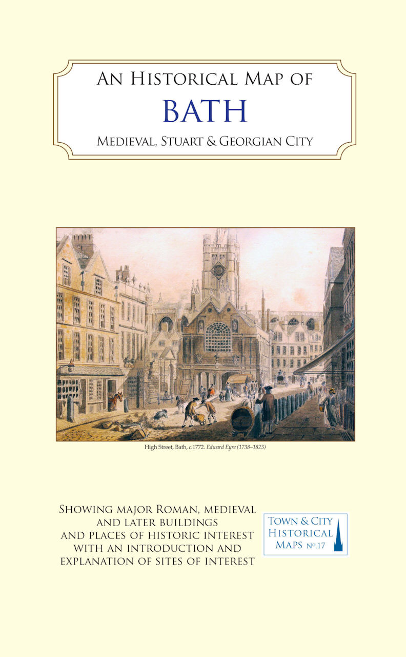
The New Historical Map of Bath Now Published and Available in Book & Map Shops and at Our Meetings
The history of Bath is well covered for Roman times, the Georgian period and later but there is a gap for the intervening period. Our map will cover these periods but also looks at Bath in the seventeenth century.
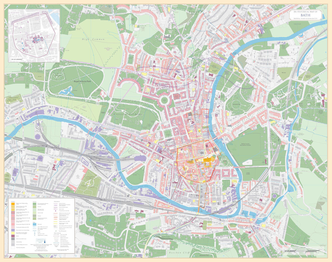
It is a double sided map similar in format to Ordnance Survey Land Ranger maps but at 1:2500 scale with a background plan of about 1900 and the main sites and buildings of interest throughout Bath's history highlighted in colour on the front.
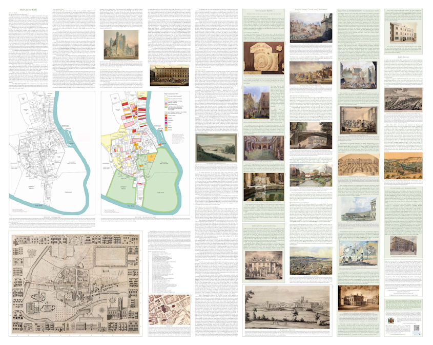
The reverse shows more detail of the seventeenth century, including valuable research carried out by members of the Survey of Old Bath on the fabric of the city. This included individually numbered plots of land relating to leasehold deeds held in the Bath Record Office, and a coloured map showing landownership and the woollen and cloth trades in the city in that century. The rear also documents the history of Bath from Roman times to the late Nineteenth Century and is illustrated with contemporary pictures of the city, mainly from The Victoria Art Gallery collection, with a number of watercolours never seen before in public.
ISBN: 978-1-8380719-6-7 Available from The Historic Towns Trust and all good book and map sellers.
Note that the New Bath Historical Maps Website which takes you behind the 1641 maps on the printed map is now available at: Bath Historical Maps